- About MAA
- Membership
- MAA Publications
- Periodicals
- Blogs
- MAA Book Series
- MAA Press (an imprint of the AMS)
- MAA Notes
- MAA Reviews
- Mathematical Communication
- Information for Libraries
- Author Resources
- Advertise with MAA
- Meetings
- Competitions
- Programs
- Communities
- MAA Sections
- SIGMAA
- MAA Connect
- Students
- MAA Awards
- Awards Booklets
- Writing Awards
- Teaching Awards
- Service Awards
- Research Awards
- Lecture Awards
- Putnam Competition Individual and Team Winners
- D. E. Shaw Group AMC 8 Awards & Certificates
- Maryam Mirzakhani AMC 10 A Awards & Certificates
- Two Sigma AMC 10 B Awards & Certificates
- Jane Street AMC 12 A Awards & Certificates
- Akamai AMC 12 B Awards & Certificates
- High School Teachers
- News
You are here
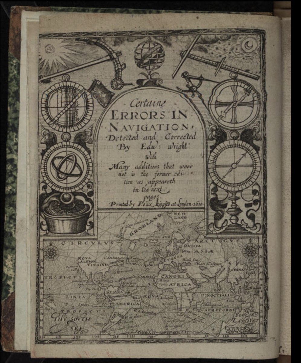
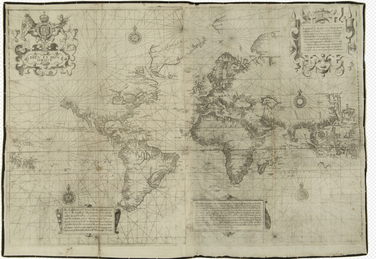
Mathematical Treasure: Edward Wright’s Certaine Errors in Navigation
English mathematician and cartographer Edward Wright (1561–1615) is best known for explaining how the mathematics of the Mercator projection work in his 1599 Certaine Errors of Navigation. Wright not only made the necessary calculations and provided them in a table, building upon the work of Pedro Nunes to show how to draw meridian lines, but he also provided a new world map based on the Mercator projection. Additional corrections and details appeared in a second edition of 1610.
Wright also worked as a surveyor, designed mathematical instruments, and pondered logarithms.
These images can be found in Wikimedia Commons. The title page of the 1610 edition was discovered by Wikipedia editors in an online exhibition prepared by the University of Virginia Library, “Lewis & Clark: The Maps of Exploration, 1507–1814.” The famous 1657 printing of the map may be viewed at Digital Commonwealth: Massachusetts Collections Online. The text of that printing may be read in the partnership between the University of Michigan Library and Early English Books Online.
Frank J. Swetz (The Pennsylvania State University), "Mathematical Treasure: Edward Wright’s Certaine Errors in Navigation," Convergence (August 2021)


